
My list of remaining 14ers is getting smaller, and the ones that are left are typically some combination of very difficult or not terribly accessible. 14,014' San Luis Peak is firmly in the latter category, requiring nearly 25 miles of dirt road driving after driving another 20 miles from the nearest city with any amenities, which arguably is Gunnison. It is not a difficult climb, being one of the few class 1 14er hikes, but it is a pretty long hike at 13.5 miles round trip. This has been a pretty sparse summer for 14ers for Nicole and me, and after some very challenging terrain in the Sangre de Cristos earlier this summer, we were hoping for a relatively mellow "gimme" summit that may well be our final one of the summer.
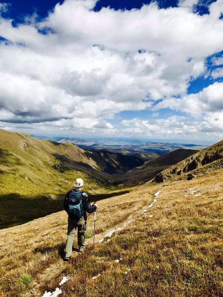
On Saturday September 18, Nicole and I left Gunnison at 4:45 AM for the two hour drive to the Stewart Creek Trailhead to climb the Northeast Ridge route of San Luis. We arrived not long after sunrise and were on the trail at about 6:45. The forecast was for a very slight chance of afternoon showers and high winds, but for now it was clear and chilly, about 35 degrees.

The first 4 miles of this hike are very gentle, only gaining a few hundred feet per mile as it follows Stewart Creek up this valley.

The sign in the picture above says "San Luis Peak - 5 1/2". That is complete BS from trail mileage, but maybe as the crow flies. After a couple of miles, we began to see some fresh moose tracks, and a recent trip report said they had seen a couple moose when they were out. And sure enough, we did come across a couple bulls hanging out by the creek. They watched us pass but had no interest in moving from that spot.

After about 4 miles, we left the woods and got a better view of the upper basin that we would soon be climbing out of.


In the picture above, the slope off to the left leads up to 13,800 foot Organ Mountain. The snow crested peak right of center is on the eastern part of the San Luis summit ridge. We would be hiking into the saddle between the two and fortunately would not have to climb either to get to the true summit.
Up to now, the elevation gain had still been really mellow, but about 5 miles in, at the back of the basin, we would have to start some more serious climbing. The first go would be an 800' climb to the saddle between the San Luis ridge and Organ Mountain.


This next picture looks back down the basin from just below the 13.100 foot saddle.

And on the saddle, looking back across the ridge that leads to Organ Mountain.

Ahead of us, we had another 1000' of gain to reach the true summit of San Luis, which is on the far left in the shadow. The snow crested peak in the previous pictures can be seen here on the right side, and the trail can be faintly seen as snow on the lower left shoulder of that peak.

As we trudged up to the ridge, the great dirt trail turned into talus. There were at least 4 humps along this ridge, and we would traverse under the first couple before crossing the ridge to the back side and continuing to work up to the summit.

There had been a little snow the previous week, and with the cold temperatures, there were still some areas of the trail that had a few inches on it, but it wasn't too bad. This is me just below the summit.

And this is Nicole as she reached the summit.


This would be my 36th summit and Nicole's 34th. It took about 4 1/2 hours to get up here. The wind that had been in the forecast, and a taste of which we got as we reached the saddle below, vanished at the summit and we were left with near perfect weather. The leaves were starting to change in the high country, and the views of the San Juans were jaw dropping.
Here is some video of the summit.
This was the view to the west.

Zooming in, you can make out the unique shape of Lake City 14ers Uncompahgre Peak, dead center in the distance, and the shark fin of Wetterhorn Peak just to its left.

This next picture looks down the ridge to the saddle we just climbed. Organ Mountain is on the far right, and you can see the rock formation from a previous picture between Organ and the saddle.

A closeup view of Organ Mountain. We wondered if the name came from the rock formation on the right side of the summit block that looked like a pipe organ.

Looking slightly more to the north, 13,983' Stewart Peak can be seen on the far left. It is the 2nd tallest 13er in the state.

This is the Southeast Ridge of San Luis, looking toward the town of Creede. Another route to San Luis comes up from this direction.


The summit itself was actually pretty small and had a great wind shelter (although we didn't really need it this day). We hung out on the summit for at least 30 minutes, snacking and enjoying the views, before we started to make our way back down at about noon.
The hike down was much quicker than the ascent. Just off trail, we saw this large cairn. You can see the summit of San Luis in the background.

And we got an even better view of the rock formation leading to Organ Mountain.

And then we started our descent from the saddle.
The sun was higher now, and the gold in the vegetation on the wall of the basin really came out now. This is looking back up at the saddle.

We had to cross Stewart Creek a couple times along the way, but it wasn't a big deal.


After about 8 1/2 hours and over 13 miles on the trail, we finally made it back to Nicole's Jeep, another successful 14er summit in the books. The weather continued to hold, and the clouds, which had gotten a little more thick, really helped to control the heat of the sun. It was a perfect hike in nearly every way it could have been.
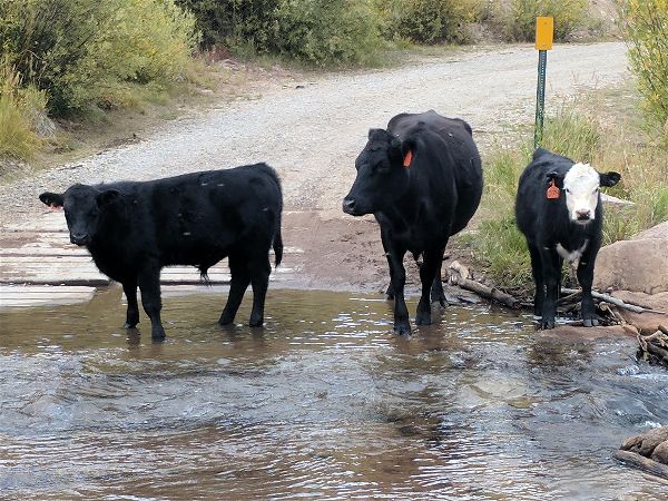
We packed up our stuff and headed out. On the way in we drove across several cattle guards and we saw many cows along the side of the road, but when we came back across Nutras Creek, these cows were in our way and reluctantly moved only after we nudged the Jeep right next to them.
There was a lot of color in the trees surrounding the road and on the mesa we were driving above. We couldn't see any of it on the way in, but we stopped several times on the way out to admire the view. Colors are still not at their peak, but were still incredible.

Our newly bagged peak in the background. Organ Mountain on the left, Stewart Peak on the right, and San Luis, the tallest of the three, actually looks the shortest in the middle.

The San Juans are probably my favorite Colorado mountain range, and I loved getting to see it pretty much in its entirety from over 14,000 feet in an area I've never been near before. San Luis is arguably the most isolated 14er in the state, and on this beautiful September weekend, we saw just four other people on the trail the whole day. The traditional fall 14er hike continues another year, and it was one I won't soon forget.