
I had just come off a couple of weeks of some great hiking that felt really strong. In Lake City, though, I was hoping to bag three new 14ers but I was only able to get one. My goal this summer is 10 new summits, and the summer is going quickly. Fortunately, it turned out that this weekend would be a good one to try to get some more 14ers under my belt, so I planned to head south to the Sawatch range to up my count.
Shavano and Tabeguache near Salida were a great target, as they are usually done as a pair and the round trip was about 11 miles and 5500 feet of gain. This certainly was not "easy", but it was definitely attainable, and maybe more importantly, the road to the trail head was passable from my passenger car. I would leave Longmont on Saturday after teaching kickboxing and get an early Sunday start on Shavano and Tab. But wait....
I got to thinking (which is rarely a good thing), if I got out early enough on Saturday, I bet I could hit an easier single peak Saturday afternoon (assuming the weather would hold) and then still hit Shav and Tab on Sunday. Three peaks! Mt. Yale looked to be just the right one, at 9.5 miles, 4300 feet of gain, and a paved road to the trail head. That would be a good one to hit on Saturday. Game on....
Saturday morning came, I got out of my house a little after 10 and drove to Buena Vista. I was keeping an eye on the weather, as the rule of thumb is to be leaving the summit by 11:00, and I would be getting STARTED about 2:00. When I got to Buena Vista, the weather was absolutely perfect, so I headed the 12 miles to the trail head and geared up.
The trail started uphill quickly, and as usual with these hikes, I tend to get winded really quickly at the start until I get into it a little bit. Today was no exception, and I thought nothing of it. I passed many people who had already summited and were on their way back after doing it the "correct" way.
There were only a couple of stream crossings. The route moved along Denny Creek for awhile at the beginning of the hike, but the trail itself was the driest of any I had seen all summer.


About 1.25 miles in, the trail turns right at this junction.

After making its way up through some woods, there is a relatively steep climb up a hillside that I remember being very tiring. This was not a good sign, as I wasn't even to 12,000 feet yet and that hill was taking a lot more effort than I had expected it to. Just above this climb were lots of flowers along the trail.

Once above treeline, you have to hike across a "shoulder" that is below the main ridge to the summit. It had some rocky areas and a few more steeper climbs to get to the top of it. The summit is in the background off to the right and still well over a mile away.

This picture looks back down the trail and I believe it was taken before the ascent of the saddle discussed below.

The crux of this climb is the 750 feet of switchbacks to reach that saddle in the above picture, and it was just brutal. I found myself stopping frequently to catch my breath and moving much slower than I would have liked, but I eventually made it to the saddle at 13,900 feet. From here, it was another 200 feet of gain over this very rocky summit block.

It was hard to follow a trail at this point, but it was generally well cairned. At one point I ascended a ridge that I though was the summit, only to see the true summit a little ways beyond it. I actually had to backtrack at that point, as I couldn't easily continue past that area without, well, likely falling to my death.
Once I did get to the true summit, I was the only one there, and the weather had held out. There was a light breeze and the temperature was perfect for shorts and a short sleeve shirt.
This summit pano looks to the north.

And this one looks to the south.

To the south, Mt. Princeton is on the left, and Mt. Antero is just left of center.
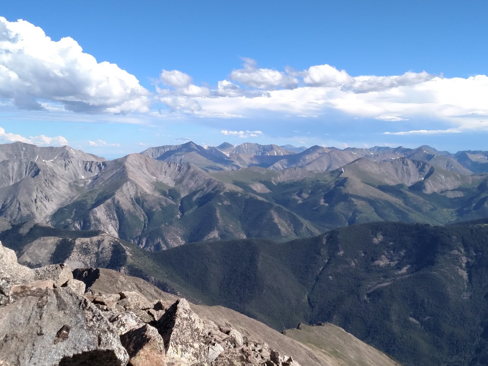
To the north, Mt. Columbia and Mt. Harvard are the first two peaks from the right. Belford, Oxford and Missouri are at center and left. Holy Cross is far back in the distance.

Here is some video from the summit.
Although I couldn't get anyone else to help with the 19 fingers, this was my 19th summit.

Although I made it to the summit, the hike was a little discouraging. No 14er for me has been easy, but for whatever reason this one just kicked my ass, and on paper it didn't look like it should have been this tough. All I can think of is that either the timing of this hike, in late afternoon, may have made some difference, or perhaps I just hadn't eaten enough that day, or maybe both. Typically, once I start my way down from a summit, I feel like I get my second wind, and while I'm always tired, I can usually get down the mountain pretty quickly. However on this hike, coming down was still very challenging, and my legs had gotten quite wobbly. It was really unusual for me to be like this on a hike, and I was trying hard to get down before dark.
I left the trail head about 8:00 PM and began the 45 minute drive to Salida. As I drove and realized that I could hardly walk and that I hadn't eaten yet, I decided that unless some miracle happened, I would not be climbing Shavano and Tab the next day. To beat the forecast storms for Sunday, I would need to be on the trail by sunrise (5:30 AM), and it was about a 45 minute drive from my hotel to that trail head. Needless to say, when morning rolled around, said miracle did not occur, and I ended up exploring Salida for awhile and heading to the S & T trail head to see what I had to look forward to next time.
Salida is a cool little town. Exceptionally friendly people there, and lots to do.

Mt. Shavano (taller peak in the center) from the road to the trail head. This will be here for another day.

My hike time was about 5 hours and 45 mins, including about 20 minutes on the summit. I got another peak bagged safely, and that is the important thing, even if it didn't feel all that great. One of my favorite sayings is "it is not the mountain we conquer but ourselves". Totally true on this hike.
On a side note, I had to get a picture of my Yale keychain with Mt. Yale in the background. I used to collect keychains in high school, and a friend of mine gave me this one that has proven to be very durable and that I've been using ever since. Thanks Yahnia!


