Sunday, September 8, 2013

Long's Peak

When we first moved to Colorado, I remember driving to Longmont with our Realtor and asking her what that huge mountain was that was so prominent just west of town.  Of course, it was Long's Peak, and I was immediately drawn to it (as I think many people around here are).  In fact, one of the requirements for our new house was that there had to be a view of Long's out one of our windows.  (And that requirement was in fact met).

I've considered climbing Long's for a few years now, but while I researched pics and vids of the route, I came across terms like "The narrows", or "The ledges", or even "The hearse".  Considered one of the most difficult 14er hikes in all of Colorado at a 5,000 foot elevation gain and a 14+ mile round trip, I had never gone out of my way in any given year to try this hike before snow eventually fell on the peak which meant (to me anyway) that 14er season was done until next year.

Well, after a false start a couple of weeks ago (had to cancel the hike because of a bum hip), I finally got to hike Long's today with my friend Sid.  This would be Sid's 4th summit of Long's, which I thought was great, b/c I really wanted someone who A) knew the route pretty well, and B) would gladly match my sure to be slow pace up the mountain.  Sid did both and was a great hiking partner.

Before I get into the details, I want to apologize for the quality of some of the pictures, as I didn't want to drag my good camera up that trail so I had to use my camera phone.  Actually I'm not apologizing, just warning you. ;)

We got on the trail about 3:15 in the morning.  One thing (the only thing?) I love about being out there at that time is that the stars are unbelievably bright.  We even saw a couple of shooting stars.  Breathtakingly peaceful country.  Here was sunrise.


Shortly after sunrise, Long's Peak came into view.
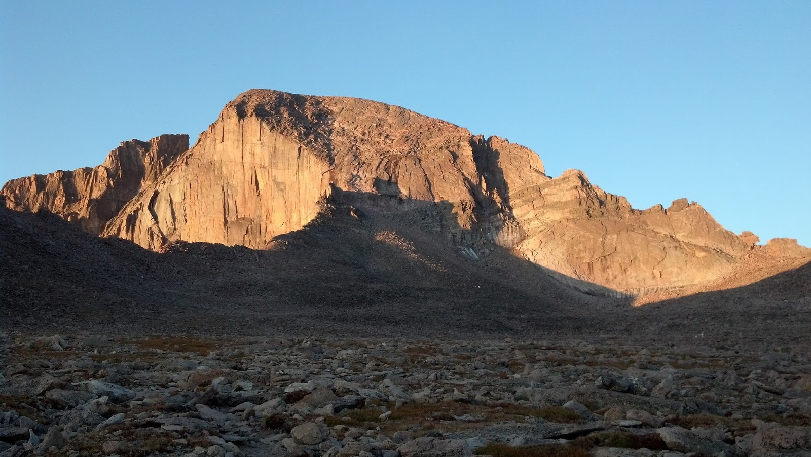

The notch on the far right side of the picture is the "keyhole", and that is essentially the gateway to the back side of the mountain.  In front of the keyhole is an area called the bolder field, which is exactly what it sounds like...a large area with giant bolders on the ground that you have to scramble across to get to the keyhole.  Not my favorite part of the hike.  This sign in the bolder field looked pretty foreboding, though:


I've been part way up the main trail before but had to turn back before the bolder field.  The keyhole is about 6 miles from the trail head, and today I got my first glimpse of the the scenery beyond it.  It didn't disappoint.


From the keyhole to the summit, there are several well known areas that I was really excited to get to finally see first hand.  The first is the ledges, which is an area where you have to skirt around on some fairly steep rock to make your way to the other side of Long's and below the summit.  You can see some people on the mountain here.  It generally was not too difficult, though there were a couple of spots that required you to climb over some exposed rock.


After the ledges, you reached the trough.  This is what it looks like from the bottom (that's Sid on the right):

And this is from the top:

How to describe the trough.  Take your least favorite thing, tilt it up about 120 degrees, add some loose rock, add some bigger loose rock for good measure, then at the very top of it, after you're tired, add a face of rock that isn't huge but big enough that finding handholds to climb over it gets a little challenging.  That would about do it.  This section was my least favorite of all, just slightly more despised than the bolder field in my book.

After you get to the top of the trough, you get to swing yourself up onto a shelf that is about 1 rock wide and enjoy the view of the cliff on the other side of the shelf.  This leads you into "the narrows", which is a short distance of some pretty exposed rock that you have to make your way across.  I didn't get any pictures of the narrows, however at one point there is a rock at the bottom of the valley that is called "the hearse", because, well, it looks like a hearse if you use your imagination.


While there was some exposure here, I never felt like I was in danger of falling.  Careful movements are all that are needed to get through this area, and we did that.  Dodging traffic coming toward you from the summit could get interesting at times, though, on the thin shelves.

Finally, the last stage before the summit is "the homestretch".  Everyone takes and posts almost this exact same picture of the homestretch because from the bottom, it looks like it is almost straight up:

And it is indeed pretty steep, however there are seams in the rock that make it very climbable.  I would consider myself about a zero on a scale of 1-10 on technical climbing ability, and I was able to get up it with minimal problems.  Of course, I never looked down either. ;)  And getting down the home stretch after summiting was also pretty nerveracking but doable.  I actually really liked this part...it was pretty short, and the dynamic of people who were just coming down and those who were just about to summit was very encouraging and friendly.

The summit of Longs is pretty large.  When we got there, there were maybe 15 others on the summit (almost as many had just descended right before we got up there, though).


This last picture is the view from above the diamond face of Chasm Lake.  I've seen the summit of Long's from that lake before, but I'd never seen the lake from the summit until today.  It was a great view.

I actually had another motive for climbing Long's Peak.  My dad died in January 2005, and I've always thought it would be cool to spread his ashes on the summit of Long's Peak, where I'd have something to remember him by every time I saw this mountain.  Today I was able to do just that.


All in all, it was a very memorable and difficult hike, but it was worth the effort for many reasons.  We summited in 7 1/2 hours and were back at the trailhead in 13.  Pretty slow pace, but we both made it back safely and that is always the main objective, right?  Thanks again to Sid for being a great guide and great company today.  Long's, consider yourself officially bagged.  And rest in peace, pops.

Monday, July 15, 2013

Democrat / Cameron / Lincoln / Bross Climb

Having recently finished training for a half marathon, I was ready to go climb a 14er or four.  I have never done the Democrat / Cameron / Lincoln / Bross (known as the "Decalibron") loop before, and since this was a good opportunity to climb four 14ers in one shot, I headed down to Fairplay to give it a try.

I've never been a camper, so camping at the trailhead the night before wasn't really an option for me.  Instead, I stayed the previous night in a hotel in Fairplay.  I had hoped to get to bed early and get some good sleep for an early start the next day, however two things prevented that.  First, there was a women's biker rally going on in Fairplay that night, and second, the walls in the hotel were mighty thin.  So, four hours of sleep it would have to be.

I arrived at the trailhead which was near Alma and was on the trail by 5:45 Sunday morning.  Maybe a dozen or so campsites, and a handful of people began hiking the same time I did.  Temp was in the lower 40s, very clear and very calm winds...a perfect day to hike.


The loops starts in the lower left corner of this map, heads up and to the left to hit Mt. Democrat, backtracks slightly across a saddle over Mt. Cameraon and then a little further up Mt. Lincoln.  It backtracks slightly again and cuts under Mt. Cameron across another saddle up towards Mt. Bross, then comes down the other side of Bross and back to the Kite Lake trailhead.


These two pictures are looking back across the valley to the trailhead.  Kite Lake is in the first picture, and the foreground slope to the right in the second picture is the start up the side of Mt. Democrat.  Democrat was fairly steep and the trail was very rocky.  The rocks were big enough that they didn't slide when you stepped on them but not huge boulders generally.  The picture below gives a little idea.


The summit of Democrat appears to be at the top of the steep slope, as shown in this picture, but when you get to that point....

You see the REAL Mt. Democrat still up ahead in the distance.  There was this one snow field I had to get across, which was maybe 50 feet with a heavily worn trail through it, so it wasn't a problem.


This was the top of Democrat.  I think it took me about two hours to get to the top of it, and it was a bit more difficult than I had expected it to be.  I don't think too many people had been up there before me that day, as I only passed maybe a half dozen people coming back.  There were maybe a dozen people on the summit when I left a few minutes later.

The next peak, Mt. Cameron, is a 14er but isn't always considered a true 14er because of its proximity to other peaks.  There are "rules" for purists that state peaks must have a certain distance and/or elevation change between them to "count".  As I am not a purist by any stretch, it still counts for me. :)

I had to climb back down the steep slope of Mt. Democrat, and I was very glad to be coming down as I saw the strained faces of many other who were coming up.  Eventually I was in the saddle between Democrat and Cameron, which was marked by a small abandoned mine building (these buildings were EVERYWHERE on this hike).


I didn't get a picture of me on Cameron, as it was just a large, open, flat area on the way to Mt. Lincoln.


It was interesting to see how the summits of Cameron and Bross almost looked lunar.  They were topped with gravel and not the large rocks prominent on the other peaks.  This picture above shows Mt. Lincoln in the distance, which was my next destination.


Mt. Lincoln is probably my favorite peak of all the seven 14ers I've done so far.  It has a fairly small summit area, and it just juts up way into the sky.  It reminded me somewhat of little "sand castles" I used to make as a kid when you let really sandy water run out of your clenched hands and it made little sand spires.  It had larger rocks, and the view was spectacular.  Mt. Quandary is in the picture above, and Grays and Torreys Peaks can be seen far off in the distance.  I believe several other 14ers can be seen in the distance from this summit as well.  While I was up there, a couple of mountain goats came up to see what was going on.


There were less than 10 people on the summit with me.  It was fun to look back at the ant line of people going up Democrat back in the distance where I had been a short time ago.  I don't remember the exact times, but I think I was on top of Lincoln about 3 1/2 hours after I started, so probably about an hour and a half after I had summitted Democrat.


After Lincoln, I backtracked again, headed below and around Cameron, then came up to the saddle up to Mt. Bross, which is in the picture above.  Mt. Bross is unique in that it is private property, and the property owners actually closed access to the peak in 2010.  There have been discussions underway since then to try to get access reopened, but as of last Sunday, Bross was still officially closed.  Officially.  I hung out for a couple minutes at the "Bross is closed" sign until a group of 5 hikers approached.  They read the sign, then one of the hikers apparently was a lawyer who said she could get us off if we got busted up there.  That was good enough for me, so I made friends with them quickly and followed them up the trail to the illegal summit.  I guess there goes my chance of ever running for office, what with a skeleton like this in my closet.


Like Cameron, the top of Bross was very large and very flat.  It offered some great views of the bowl of 14ers I had just hiked that morning, but I didn't go look across off of the other side for fear that the peak po-po were waiting just over the edge.  I got my picture with the "DeCaLiBro" sign that was written on a rock up there, and we all began our descent down the other side of Bross.


I had been warned that this route down was pretty steep and full of scree, and that was definitely true.  It was a very slow crawl down the trail, and my climbing poles came in very handy for stability.  The pictures above show the side of the mountain and how steep it was, and the second picture is the path back down to the trailhead, which can be seen in the distance at the bottom of the valley.  By this time, some storm clouds were starting to move in, so the timing worked out really well to be coming down when we were.  We actually passed a couple hikers who were nearly to the top of Bross who had come up the way we were going down.  They said it took about an hour and a half to get up from the trailhead, and they were planning to do all four 14ers, even with the storms coming in and not having completed one yet.  They either didn't make it or died on the summit of one of them, I'm sure of it.  Very foolish.


After getting past all the steep slopes and scree of Bross, there was some much nicer trail closer to the trailhead.  This waterfall was just part of the beautiful close-up scenery.

In all, the hike took about 6 1/2 hours, was about 7 1/2 miles long and was very strenuous.  Some of the trail up Democrat and down Bross was a little hard to follow at times, but generally could be found if you continued in the direction you knew you should be going.  Not sure I'm eager to do this hike again now that I've done it once, but very glad I was able to get all four 14ers in the loop under my belt.  Gears are already spinning for my next one. :)

For anyone interested, here are the Runkeeper graphs for my hike.  It stopped tracking in the middle for some reason, so there are two halves posted here.


Thursday, August 16, 2012

Are We Going...to San...Fran...Cisco??


This summer we finally had the opportunity to visit my aunt and uncle's family in San Luis Obispo CA.  I constantly stalk them and their four "kids" on Facebook but sadly don't have a chance to visit with them very often.  In fact, the last time I saw them was when my dad died about 7 years ago.  This time, my cousin Emily was getting married, and although it was every bit as busy as you'd imagine, it was a much happier occasion.  Even got to see my mom and brother from GA for awhile, which is always a great time that should happen much more frequently. 


That's the Lawrence crew above.  You'll never guess which cousin was the one who got married, would you?  She really looked amazing in her wedding dress, too, and everything about the ceremony was exceptional.  The wedding was actually held on a working orchard that grew lemons and avocados.  I'd never seen an avocado tree with actual avocados growing on it until that day.  It was hard not to pick any.


Another cool thing about my uncle's place is that he raises tortoises and has for many years.  We got to see his tortoise pen, and Becca fed some lettuce to them.  The scene looked similar to when we get Bella's food out and how she comes racing towards us and gets all excited and drools everywhere, only the tortoises (tortii?) were moving at about 1/100th speed and never looked you in the eye, they just stared at the lettuce, then did this big yawn looking thing and took a bite out of the lettuce.  After getting a mouthful, the tortoise would chew it up.  For some reason, seeing a tortoise chewing its food made me laugh.  


After the wedding, my family hung out with my mom and brother.  We did a quick hike and went to Avila Beach for an afternoon.  The first night there we went to dinner and then dipped our feet in the unflatteringly cold waters of the Pacific at sunset.  A little chilly for a swim, but a beautiful sunset anyway.


We stayed the weekend in SLO visiting, then Kathy and the kids and I drove up the coast to San Francisco.  It was a several hour long drive next to some of the most beautiful, foggy cloud cover I've ever seen.  Every so often the road would turn so you could see the often jagged cliffs we were driving in, which truly was amazing.  I really like the geography of the west coast...so rocky and "sharp".  But this is fog season, so unfortunately most of the time we couldn't see more than 50 feet in any direction.  We did stop at Montana de Oro state park on our way out of town.  We didn't spend nearly enough time there, but it would have been a great place to explore some of the coast around SLO.


One famous area of this road is where elephant seals like to hang out.  The day we saw them, there were only a couple hundred probably, but I  understand sometimes there can be a thousand at this place.  I believe this was my first wild elephant siting, which combined well with my first native avocado siting the previous day.  


We also spent a few hours at the Monterey Bay aquarium, which was every bit as impressive as we'd been told it was.  That evening, after enjoying our first In and Out Burger (1st #3), we got into SF.  We dropped the car at the airport and took a taxi into the heart of downtown.  

I'll spare you the agony of a detailed report of all the places and things we did in SF, but we did get to see quite a bit in 4 days.  No, we didn't take the Alcatraz tour (everyone always asks me that first, so figured I'd get it out of the way now).  We DID see Alcatraz from many different angles, and it was very cool looking.


This shot came from the deck of the tour boat we rode that gave us a quick tour of SF Bay.  We went around the back side of Alcatraz and also went under the Golden Gate bridge.  

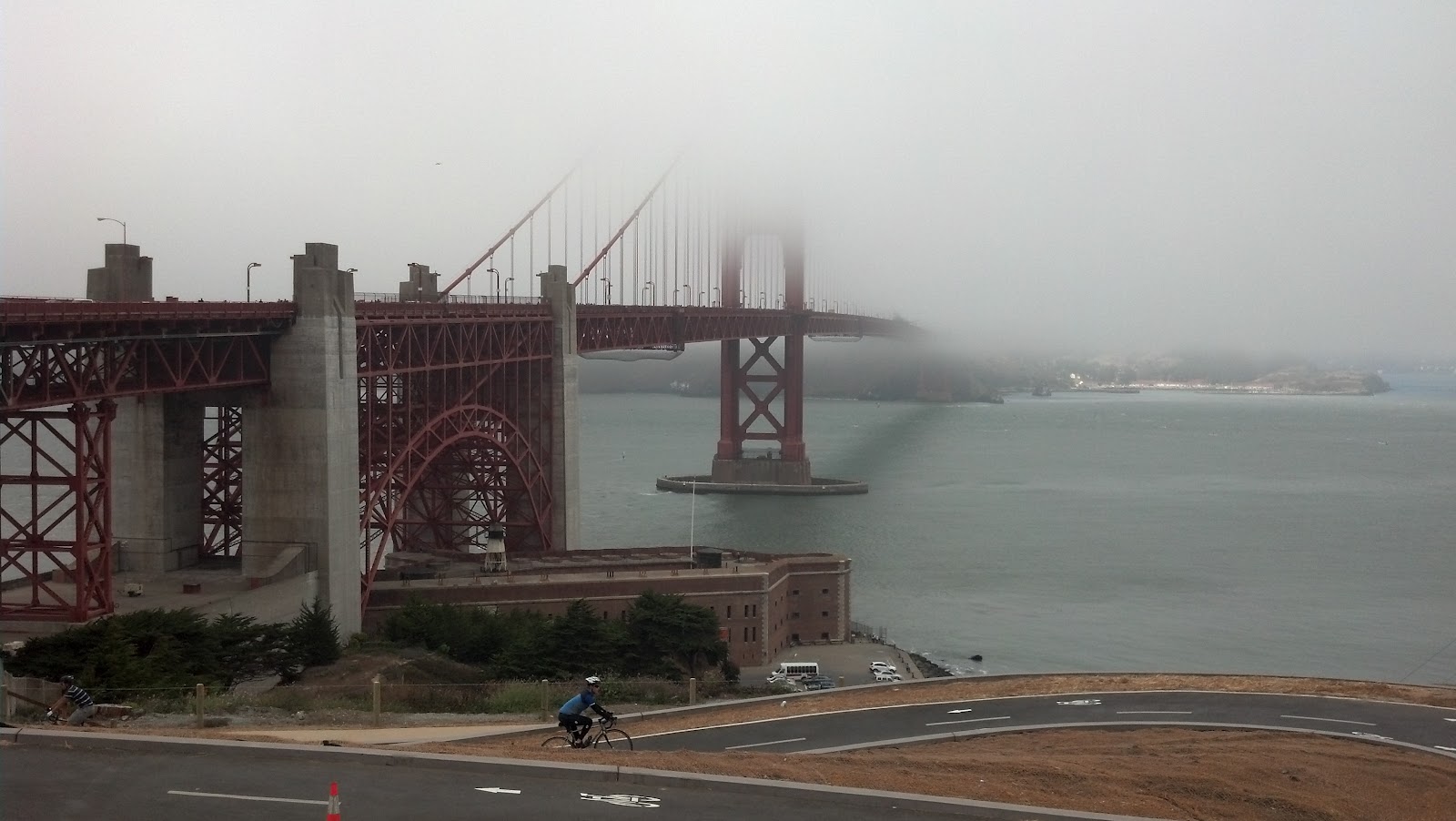
The bridge was spectacular.  There is a large visitors center that tells a lot of the history and stats, along with all of the touristy souvenirs you'd expect.  Every day the bridge was enveloped with fog.  It was very interesting to me that there was a swath that seemed to go right across the bridge that always was a fast moving layer of fog.  The weather at the bridge when we visited was very dreary and windy and chilly, but just a few blocks inland, it was perfectly sunny and pleasant.  Apparently the "micro climates" around SF are well known.

Yes, we did ride the cable cars.  There was always a long line for them, and the cars were always completely packed.   The operators were generally very business like, even gruff sometimes, which surprised me a little.  When one of our rides stopped at Lombard Street, the driver said "OK there's the most crooked street in the US or whatever you want to call it.  OK?" and then he took off.  Not that this was a tour bus we were on, but it struck me funny how this guy must have driven past this street a thousand times and was obviously not so impressed anymore, nor did he understand why anyone else would be impressed either.  This picture shows how steep the streets were around there.


That said, we later road a regular bus across town, and the driver of this bus was more than happy to talk with anyone.  He seemed to know some of the regulars that got on during the trip, and after they left he'd give us their history like he was best friends with the person.  Every bus driver should have been like him.  He wasn't just doing his job, he was genuinely being a friendly guy and was more than happy to help all the tourists who had pretty basic questions about where they needed to go.  Awesome guy.

We made a visit to Coit Tower, which is visible from just about anywhere in the city.  It used to be a fire lookout, and there is a lot of history associated with it, but it really was a basic, tall tower with amazing views of the city and the bay.


The second shot is across Fisherman's Wharf, which is the main touristy entertainment/dining district.  Alcatraz is beyond that.  A couple things stand out on our visit to the tower.  First, we had to walk several blocks to get to it, and those were some of the most ridiculously steep roads I've ever seen in my life.

The grade of this hill is just over 30 degrees.  THIRTY.  This picture doesn't do it justice. And people were actually jogging on streets like this.  The other thing that caught my eye was the capacity sign on the completely packed elevator we took to the top of the tower.  2000 lbs.  And there were 15-20 people on all the rides.  Math was never my strong suit (well, actually, yeah it kinda was), but I'm thinking the capacity was exceeded a time or two during the day on that tower.  I'm sure the safety factor was about 10 though, so it was probably fine.  If you are claustrophobic, I would recommend trying to find your view of the city elsewhere though.

We also visited the California Academy of Sciences, which was a very well kept science "museum" of sorts with lots of focus on nature and the environment.  It even had an "earthquake simulator".  And then there was the Exploratorium, which was a hands on museum that explained everything from sound waves to inertia to optical illusions to human behavior, with interactive exhibits to help get the point across.  It was also very well maintained, especially given that with any interactive exhibit, kids are going to find ways to interact with it in completely unintended ways.  Needless to say, all the scientists in my family really loved that place.  It was behind this building, the Palace of Fine Arts.  Very cool looking dome and park area.


Chinatown was another unique experience.  We went out that way once looking for dim sum, but every place that was recommended looked like you really had to know what you were doing in order to do it right, so we went back and forth across the area for quite awhile before settling on a place that looked like it was totally made for clueless tourists, but at least we could say we did dim sum in Chinatown.  Many of the markets there were packed, with constant streams of people just picking through the produce and I assume paying someone for what they wanted.  The whole place seemed to be in constant motion with tourists scattered about just gawking or trying to figure out where they were on a map.  The picture below was from the main entrance.


The opposite of this scene was across town at the Japanese Tea Garden, which was a very tranquil place with gardens and ponds and trees that a person could just lose himself in for hours.  For a few bucks, you could even have a geisha perform a tea ceremony for your group.  We opted instead for the more affordable "serve yourself" hot tea and mochi ice cream balls.


Speaking of tourists, there were a lot of us there, and we were from all over the globe.  My favorite were the French tourists.  Almost every French family I saw had sons that looked like they were trying really hard to be in fashion (and maybe they were...I certainly wouldn't know fashion if it bit me on the behind).  The daughters looked remarkably snooty and almost all of them wore scarves.  Now don't get me wrong, I'm not trying to be judgmental, but it always reminded me of a scene from the movie European Vacation.  I'm sure they were all very cool people, but the stereotypes in play made me laugh.  I did get to see a very young French girl who was being scolded for something by her father, and she just sniffled and whimpered "wi" in the most pathetic voice you can imagine.  So I bought her a pony and told her dad to lay off.  Adorable kid.

I finished the trip over drinks with an elementary school friend of mine from Morris, Charles Lee.  It had probably been about 30 years since we had seen each other, and we were easily able to pick up right where we left off.  If any of my Morris friends' ears were burning a couple weeks ago, I swear all the talk was of good times.  It was great to get caught up again.


So after promising not to go into exhaustive details....there are the exhaustive details.  We had a great time seeing a lot of my family, and the touristy parts of SF that we saw were a lot of fun and made me want to go back and check out more of the outdoorsy stuff there.  I wish my cousin and her new husband a lifetime of happiness, and I hope it doesn't take another major life event to get us all together again.